Friday, September 05, 2008

Day 3: Saturday 30th August
High Skies; High Ambition

I had a look outside on Saturday morning before breakfast. The clouds were well above 2,500 feet. The forecast was for much lower clouds - but I didn't believe that - the day looked pretty good. We all slept like logs - exhaustion makes any bed comfortable! After breakfast I waxxed the boots while the sandwich-making team were hard at work in the dining room. We got the all clear for the sore knees and we agreed to stick with the original plan.


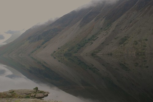
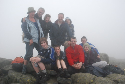
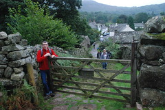
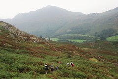
Leaving Eskdale Hostel, Uploaded by M+MD.

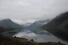
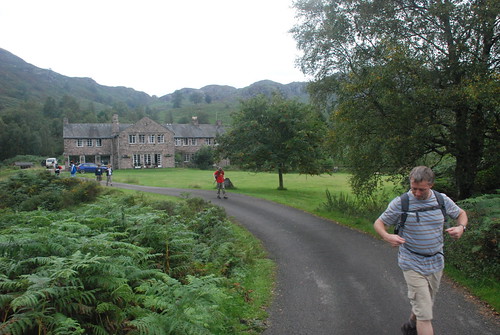
Another ambitious day - Scafell, at 3,184, the second highest mountain in England. The proposed route had an opt-out plan, to stop at Slight Side, which at 2,499 feet was a respectable alternative. This also left the option for a sub group to travel on to Scafell if they so wished. The path started just 5 minutes down the road from the hostel, so we had no driving and we were on the road before 10.15.

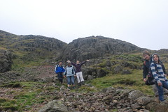
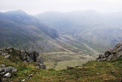
We found the path pretty easily - we were taking the better high level path this time. The path up the valley, taken 30 years ago, does have the spectacular waterfall and wonderful views looking upwards. My memory that day is that we left the climbing too late and we had a very challenging finish. The high level route had us gaining height straight away and we got to 1,200 feet pretty early in the day. After that we had a gradual climb with lovely views.


Lunchtime
Uploaded by M+MD

There were small bracken hills and crags around us. We had the occasional rowan tree. The clouds rose as the morning progressed and we had clear views of all the peaks from about 11.30 onwards. The day was warm and hazy - nothing wrong with that! The path was well defined and generally dry.

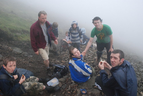
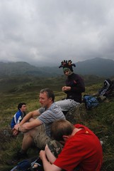
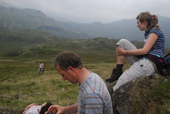
Kevin lead the way at a great pace with Christopher hot on his heels. Senan had a slow start - but then he started counting steps and before we knew it he was off with the rest of them - the old tricks are the best! By 12.30 we were ready for lunch. It was a lovely spot for a picnic. The views over the raised valley below us and across to crinkle Crags and Bow Fell were wonderful. We were making good progress and Slight Side was clearly in view and we could see Scafell lurking in somewhere behind it! Lunch was the usual fair. Lots of chat and laughter.


Waiting
Uploaded by M+MD

Feeling Cold
Uploaded by M+MD

Mark
Uploaded by M+MD

Greg
Uploaded by M+MD

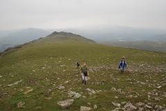
After lunch we decided to leave the path and go higher to the ridge that was about 250 feet above us. It was through wet terrain and I was not certain that it was the right option - I was afraid that the ridge above would be a false top and that a path wouldn't materialise. But when we got up we found the path and we had a pleasant, if occasionally damp, ridge walk.


The way ahead
Uploaded by M+MD

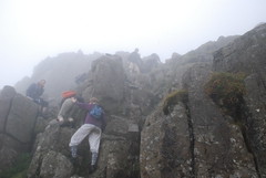
The path up Slight Side was clearly visable up ahead. When we got to the bottom of Slight Side we had a steep pull up. But with a clear path and great views it was not too hard. The mood of the group was beginning to diverge on how far we would go. But that was part of the plan - those who felt up to the assault on Scafell would lighten their packs and go for it while the second group were happy to wait and relax. We took a break about 200 feet below the summit. Mags Sheila and Senan decided to sit and wait and enjoy the view over the valley. The advance party unloaded most excess baggage and headed for the top of Slight Side. No prizes for guessing who was first on top - Christopher continued his winning performance! Greg had to keep up with him. As we rounded the last crag before the top Greg was there above us with his best impression of a human cross!


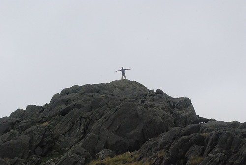
Greg on Slight Side, Uploaded by M+MD.

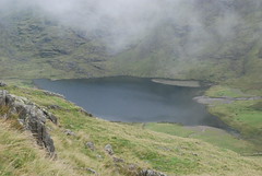
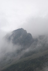
We had spectacular views on all sides. 30 years ago we did not have time to enjoy them - we were running out of time and had still a long way to go. We could also see that Scafell was not the second highest mountain in England for nothing. There was a ridge walk ahead of us up to 2,800 feet and then we had to lose another 150 feet before reaching the top. It was now beginning to look far away. The ground was getting rockier - though there was still a lot of green. On we went and we reached the next summit in about 20 minutes. There while taking on liquids and chocolate we met a group who had just come down from Scafell. They said that it had taken them an hour to get down. That was hard to believe. But even if we could do the round trip in an hour - which would be a challenge we would still be leaving the resting group waiting a long time. So we decided that we had reached turn-back. Scafell would still be there next year. We enjoyed even more spectacular views as we were almost directly above the valley below.


Last Top
Uploaded by M+MD

Straight Down
Uploaded by M+MD

So we headed back skirting around Slight Side and rejoined the waiting group. It was another excuse to sit down and regroup and eat some chocolate and biscuits! They had found a good spot - sheltered under a rocky outcrop but perched above the open ridge and valley below. You could even see the Irish sea, hazy in the distance. A few photographs and then on we went. The descent was steep and fast - the path was almost a scree run in parts.


"What - Another Photo?!", Uploaded by M+MD.

We were back on the ridge pretty quickly. Now that were not under time pressure the idea was to take an alternative route home - as suggested by Wainwright! We found the ridge path all the way and descended down via Stone Tarn and Ell Tarn. The path on the way down did get quite wet and after a long day walking, the group we were stretching out over a wide distance. Remind me to put lead in Christopher's boots next year. (oh yes I think there will be a next year!). Down we went passing Stone Tarn in the distance and then the path round around to Ell Tarn where we regrouped and took another break. We were still above 1,000 feet so the views over the very green Eskdale Valley were very pleasant. Greg was resting on the opposite side of the Tarn. .


Nearly Home
Uploaded by M+MD

Grinning
Uploaded by M+MD

Last Stretch
Uploaded by M+MD

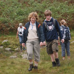
The walkie talkies were a great addition - mobile phones generally don't have the coverage. Greg talked is through the boggy part around the lake and we all joined up to trail down to the bracken. The Woolpack pub (just beside the hostel) was where this path finished. For some of us, it was the thought of a nice cool pint that kept us going. Down through the bracken we went - again streching out as we travelled at different speeds. The pint in the Woolpack was most refreshing.


Woolpack Inn
Uploaded by M+MD

We headed back to the hostel for showers and a clean up and decided to try the Boot Inn for dinner. We had another excellent meal and another pint before we returned for a well earned sleep. The morning promised a ly-in and what should be an easy run back to the boat.

Thursday, September 04, 2008

Day 2: Friday 29th August
Mirror; Mountain; Swim

The original plan for Day Two was a two car hike - starting at the top of Wrynose Pass and going to Crinkle Crags. However given the actual challenge of going over both passes yesterday we decided that was a very dodgy option. In addition the sky was low and the tops were misty which took away one of the main features of the planned walk - the panoramic views of the Langdales on one side and the Scafell Range on the other - from the long ridge walk.

So a second plan was devised: Great Gable from Wasdale Head was the idea. This also accommodated Sheila's ambition to swim in Wastwater, England's deepest lake. We drove around from Eskdale to Wastwater and as the lake came into view, it was a most magical sight.


Wastwater Morning, Uploaded by M+MD.

The water was so still that it acted like a perfect mirror reflecting the screes above. It was almost impossible to tell the difference between the waterline and the bottom of the screes. We stopped the car and just took in the marvellous scene. The top of the screes were in mist - the mist was the only blur in the perfect reflection.

We eventually moved on to the car park beside Wasdale Head Hotel. Great Gable and anything over 1,000 feet was covered in mist but it was warm and there was no sign of rain. We set off up the valley with multiple options and variations for the actual route running around in my head. I fancied the spectacular south traverse which is a very well defined path set on scree runs around the middle of Great Gable travelling under the impressive craggy outcrop known as Napes Needles and with views up the dramatic scree runs with the forbidding names; Little Hells Gate and Great Hells Gate. The traverse also gives spectacular views across to Scafell Pike (the highest mountain in England). But with the mist down, which would spoil the view, and a plan which was already ambitious, the traverse felt like an unproductive luxury. I began to think of alternatives.


Decision Point
Uploaded by M+MD

Where To Now?
Uploaded by M+MD

After we crossed the footbridge the paths diverged and a choice was made - the harder more direct route up and the easier gradual route down. That ended up being the theme for the day: take the tough option! We turned left and started to climb quite quickly - I began to worry that maybe this was too ambitious for the second day. But we had a couple of stops and after a while we were over 1,000 feet and in the mist.

Kevin has an altimeter on his phone and that was helpful and encouraging at first - we could clock up the feet of ascent. But then came the hard questions - "how high is Great Gable anyway?" When you are only just above 1,000 feet and feeling pretty tired the one answer you don't want to hear is "2,948 feet" especially when Kevin has told you that we left the car at 180 feet and so you have completed less than one third of the climb!

The path was good all the way. At about 1,700 feet we were in the thick mist and it was about 12.30 and we agreed it was time for lunch. It had been a strenuous start and there was still a long way to go but a cup of tea and some excellent sandwiches made a big difference. We rested in a pretty precarious spot perched on the path with Great Gable above and behind us and the invisible Kirk Fell in front of us. We could hear the steam in the gully between the mountain rumbling loudly down but we could just see ourselves. It was just as well that no one tried to pass us on the path because it was steep and the ten of us were sprawled all over it.


Lunch Time, Uploaded by M+MD.

After a good feed and a good rest we started up again. It was just a little difficult to get the limbs obeying the brain again - but soon we were climbing and making good progress. We eventually reached the traverse path - but it was very hard to see in the mist. We met a couple who had just come down directly from the top. They described it as very difficult. I finally decided against the traverse and set off continuing gradually upwards. We had 2 choices now - walk around to Windy Gap which I knew was a safe way up or take the direct back route. We took the direct route - despite the comment from the couple. The path was well marked with cairns and that made it safe enough. It's also true that path that are difficult going down can be easier and very efficient going up.

We could only see about 20 feet ahead but we were making good ground. About a third of the way up that section we met a couple coming down. "the boulders are very big" she said - they had turned back. But we were happy with our progress and so we continued.

With just 300 feet to go to the top the boulders did get big and the path became a scramble, climbing over rocks and boulders and looking for footholds. But the altimeter was a great encourager at this time and there was no suggestion of giving up. The scramble continued for about 150 feet and the it returned to a regular rocky path. Greg and Christopher forged ahead and then we could see some shapes in the distance. Christopher was the first to hit the top.


On Top of Great Gable , Uploaded by M+MD.

Because it was so misty the top looked small - my memory of Great Gable is a large platform generally full of people! But we found the commemorative plaque described by Wainwright! It was busy enough for such a misty day. There were at least 3 other groups including one group who had found the front path difficult and were thinking about the back path (that we had just come up) - I advised them to go down to Windy Gap instead. If they found the front path difficult the going down the way we came up was going to put them off the Lakes for life! I'm not sure that they followed the advise. It was time for another food and drink break on top and we got a couple of group photos courtesy of a couple with their dog Bertie.


Descent
Uploaded by M+MD

There was not so much to see. - on a clear day the view is stunning, so after about 20 minutes we set off down the front or breast path which brings us down to Styhead Tarn. This is the main route up and down Great Gable and it is the route we took thirty years ago. That also reverses the ascent of thirty year ago. The way was clearly marked with large cairns and the path which was always good and clear, had been much improved with stone steps built in for most of the way. These stone steps are now a normal on most popular Lake District routes are there to protect from human erosion which was becoming a major problem even 30 years ago. The only problem with the stone steps is that in damp misty weather they become just a little slippery. In the rain they work well but the mist makes them greasy.

We managed though and made pretty good progress down - then at about 1,800 feet the mist cleared suddenly as it often does on these days and the curtains opened on Styhead Tarn below us. Looking across we could just see the needles and the south traverse. After a few minutes the mist rolled back in but it was starting to lift. Soon we were down at the stretcher box above Styhead Tarn.


Napes Needle
Uploaded by M+MD

The idea was to take the fast route home - but we ended up on a slower but more interesting route. The descent from Styhead Tarn was about an hour longer than intended. Greg and Christopher were again leading the way. They even stopped to take their boots off and refresh their feet in the cold mountain stream. The mist was now gradually lifting and we could now see the South Traverse and Napes Needles clearly. By the time we got down the tops were all clear! We made it down in one piece and set off back via Wasdale.

We stopped again at Wastwater and without too much thinking most of us changed into swimming gear. Lead by Sheila, with Greg and myself just behind, we waded in.


Wastwater Swim
Uploaded by M+MD

Wastwater Swim
Uploaded by M+MD

It was cold and stony but we took the plunge. As long as you kept swimming it was quite pleasant. Kevin, Katy, Roisha, and Christopher followed in and after much goading Mark also took the plunge. Mags and Senan decide to remain sane, dry and warm! It was very refreshing, clear and clean; and certainly very cold. The only thing you has to worry about was the occasional fly resting on the water - good for fish but not for humans! So we had climbed a high mountain and swam in the deepest lake in England.

We decided to eat early and managed to get a table in the Bridge Inn at Santon Bridge - it was very busy - but I suppose that it was Friday night on the last week-end in August. The food and the beer was good and by 8 we were heading back to the hostel. By 10 pm some of us were ready for bed - more stayed up and played cards for another hour or so - but with another big day planned for to-morrow and with sore knees to worry about, most were in bed before midnight.

Wednesday, September 03, 2008

Day 1: Thursday 28th August
High Seas; High Passes; Low Hills


Ready for Action, Eskdale, Uploaded by M+MD.

Thirty Years Later the adventure continues. We met up as planned in Dublin Port at 8 am and were underway on time at 8.45. The sea was calm and the fast ferry was not very full, so we had a quick and easy crossing. We were on the road pretty quickly - we had our 2 separate routes mapped out on Google Maps. Mags, Senan and I diverted to Liverpool to pick up Sheila and Roisha. Greg, Kevin, Christopher, Katy and Mark headed on for the M6. We arrived in Liverpool at 12.40 and were at Lime Street station just as Sheila was walking out - couldn't have timed it better! We didn't hang around and were on the road through Liverpool via Aintree. One wrong turn quickly corrected and soon we were back on the motorway system. We stopped at a services at Lancaster and had a sandwich and did some shopping in an M&S. We stocked up with bread and sandwich materials ad well as drinks and chocolate for the walks ahead.

We met up with Greg and Kevin and co at Ambleside and I took the lead car position as we headed for the high mountain passes of Wrynose and Hard Knott which leads us down to Eskdale. The passes are high 1,200 feet - and I knew they are a little hairy - but 3 had forgotten just how scary they can be. The roads are narrow with a passing lay by every 30 metres or so. There is a lot of traffic both ways. The mist was down so viability at the top was about 30 feet! But the biggest issue is the gradient which is 25% and 30% in places. While I had the power in the Volvo - it is an automatic which is probably a help - but it feels different, changing down is not an option! Greg had a smaller engine and a very full car behind us.


Ratty and Us
Uploaded by M+MD

Mags and Senan
Uploaded by M+MD


Sheila
Uploaded by M+MD

Anyway we made it - nerves shattered! We drove past the youth hostel and on to Boot where we parked at the rail station and considered a quick ramble. The original plan had been Harter Fell - but we needed a 3 pm arrival to do that - as it was now 5 it was Plan B which was a ramble up to Burnmoor Tarn behind Boot. We followed the path and without taking out a map or compass continued for about 40 minutes. The ground was wet and the path less clear than I remembered. Burnmoor Tarn was also slow to appear and there seemed to be an extra valley ahead! It looked like we had veered off to the left.


Eskdale Hostel
Uploaded by M+MD

So the map and compass were consulted and with a course correction we headed for the hillock called Boat How and sure enough Burnmoor Tarn appeared below us. We headed back to the original intended path and back down to Boot. A total of 2 and a half hours stroll which was just what we needed to get warmed up for to-morrow.

We headed back to the Hostel and checked in and unpacked. It was then a ad scramble to make it somewhere for food. Last orders were at 8.30 so we rushed back to Brook House in Boot and made it just in time. We had a good meal and some local bitter and were back in the hostel by 10. The beds were hard but comfortable and we had a good nights sleep, boys in one room and girls in the other; youngest on the top bunk and oldest on the bottom!

Labels